April 9, 2025
AccessMap is an app and a collection of data sets that let pedestrians tailor routes for their accessibility needs and preferences. Coverage has been spreading across Washington state and now includes a new data set, called OS-CONNECT, for sidewalks and other paths statewide, from Forks on the Olympic Peninsula to Clarkston in the southeast.
AccessMap was created in the Taskar Center for Accessible Technology (TCAT), which is led by CREATE associate director Anat Caspi. When it was launched in 2017, data was limited to parts of Seattle. Over the years, it has expanded to other cities near the Salish Sea, including Everett, Mount Vernon and Bellingham.
“Not only are we including all sidewalks in Washington, which is huge, but we are engaging communities and planners in a massive effort to support data production and the maintenance of this resource long term, to make it sustainable and translatable to other institutions. This way states across the U.S. could start using it.”
Anat Caspi, Director, Taskar Center and a CREATE associate director
The Washington State Legislature (in House Bill 1125) assigned TCAT to build the OS-CONNECT data set, which the team completed well ahead of its projected 2027 goal. The team will now perform deep quality checks, work with the different communities to analyze and interpret what the data means to them, and engage citizens in actions that promote public participation in data and active transportation.
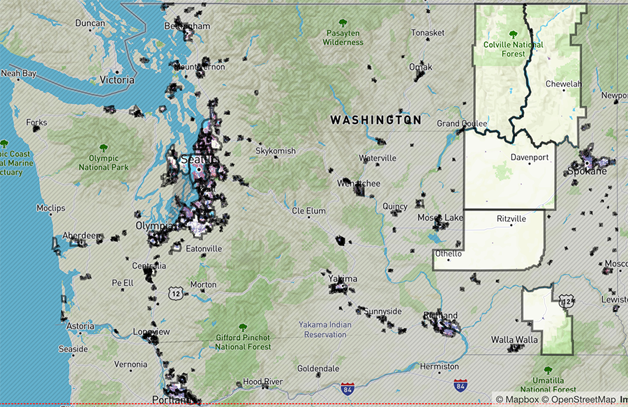
Interactive map of Washington state. Mapped cities and towns are outlined in grey.
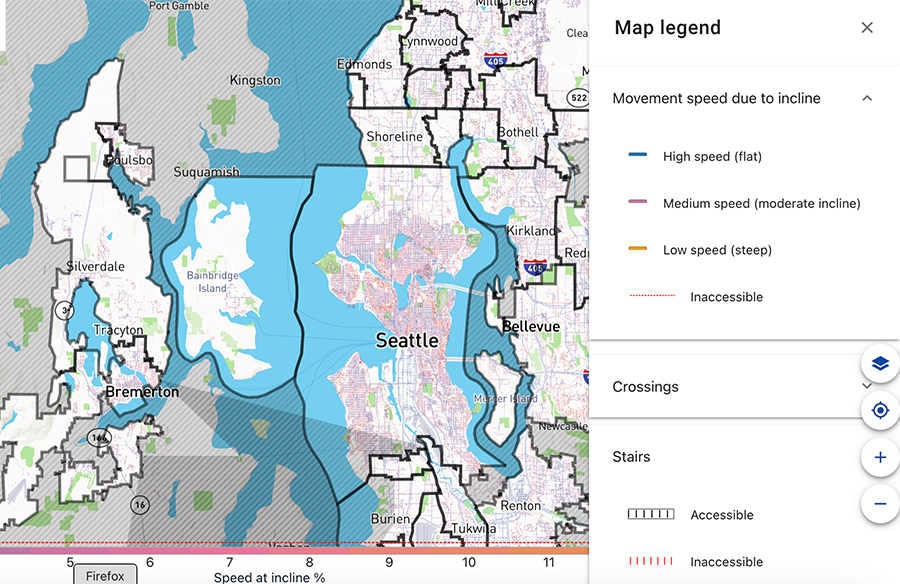
The same map, zoomed in to the Olympic Peninsula, east to Bellevue. The legend is open to show meaning of different route colors.
The Taskar Center launched OS-CONNECT
at its annual OpenThePaths conference in March. The conference brings together community members, advocates, planners, researchers and policymakers dedicated to expanding and sustaining pedestrian-friendly infrastructure.
“No state has before used machine learning and human vetting to collect, in a consistent, standardized way, all of the pedestrian infrastructure in that state,” said Caspi, a research principal in the Paul G. Allen School of Computer Science & Engineering, where TCAT is housed. “OS-CONNECT helps us answer the original question the state asked: ‘Who has access to frequent transit?’ And now we can answer many other questions, such as: ‘What type of access do people with diverse needs have to important services like grocery stores, schools and health care?’”
The state compiled OS-CONNECT using TCAT’s OpenSidewalks model, which combines machine learning with human vetting to catalogue pedestrian infrastructure. For instance, using the data set through the AccessMap app, a person using a wheelchair can plan a route only on streets that have sidewalks, don’t have an incline of greater than 5% and have curb ramps for any intersections.
The data can help local governments identify where sidewalks are in poor condition or missing. OS-CONNECT supports Walkshed, an accessibility app for urban planners, and projects such as Complete Streets, a model for equitable infrastructure design, and Vision Zero, a Seattle project to end traffic deaths and serious injuries by 2030.
This article was excerpted from the UW News article by Stefan Milne. For more information, contact Caspi at uwtcat@uw.edu.