October 17, 2022
Congratulations to CREATE Ph.D. student Ather Sharif, Orson (Xuhai) Xu, and team for this great project on transit access! Together they developed UnlockedMaps, a web-based map that allows users to see in real time how accessible rail transit stations are in six metro areas including Seattle, Philadelphia (where the project was first conceived by Sharif and a friend at a hackathon), Chicago, Toronto, New York, and the California Bay Area.
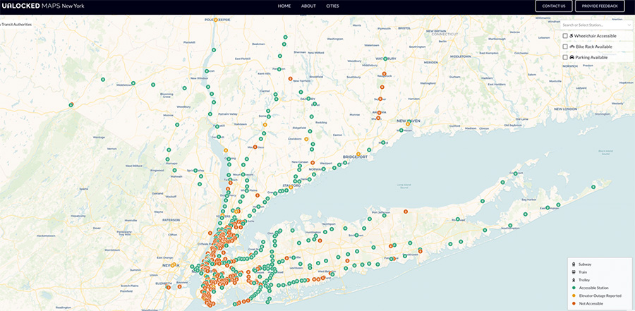
Shown here is a screenshot of UnlockedMaps in New York. Stations that are labeled green are accessible while stations that are labeled orange are not accessible. Yellow stations have elevator outages reported.
Sharif, a UW doctoral student in the Paul G. Allen School of Computer Science & Engineering advised by CREATE Co-Director Jacob O. Wobbrock, said the team also included nearby and accessible restaurant and bathroom data. “I think restaurants and restrooms are two of the most common things that people look for when they plan their commute. But no other maps really let you filter those out by accessibility. You have to individually click on each restaurant and check if it’s accessible or not, using Google Maps. With UnlockedMaps, all that information is right there!”
Adapted from UW News interview with Ather Sharif. Read full article »