September 21, 2026
AccessMap is an open-source pedestrian navigation platform that provides customized directions for people looking to avoid access barriers such as hills, construction sites, and high-clearance curbs. To prepare for thousands of FIFA World Cup fans visiting Seattle this summer—including many with disabilities—AccessMap researchers expanded the tool to include event-specific guidance.
A pin is not enough
Unlike typical mapping apps, AccessMap lets each user set a personal profile: a blind or low-vision user can dial in exactly how much detail they want at a given moment, while a wheelchair user can set the maximum incline or curb height they’re willing to navigate. The app then routes around what doesn’t work for that person, not just what’s fastest.
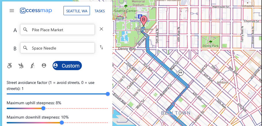
AccessMap is developed by the UW Taskar Center for Accessible Technology (TCAT), a CREATE campus partner led by CREATE Associate Director Anat Caspi.
World Cup customization: Details that matter
The TCAT team built a custom version of AccessMap for the World Cup that pushed this idea into stadiums, fan zones, and the local businesses around them. Instead of stopping at “here’s the building,” it mapped the last few meters: which entrance to use, whether there was enough clearance to get through it, and whether the door swung in or out. That level of detail matters enormously to disabled visitors, who often lose the most time and independence not on the route to a destination, but in the final approach to it.
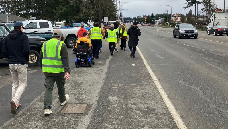
Through manual, on-the-streets validation by hundreds of volunteers, the AccessMap research team ensured that the maps would reflect the construction and pavement conditions that soccer fans would encounter during the matches.
AccessMap was also built directly into SEA&WIN, Seattle’s official FIFA World Cup companion app, so fans could navigate between venues without switching to a mass-produced map. That mattered as much for what it avoided as for what it added: an open-source alternative that adapts to how each visitor moves through a city, rather than a one-size-fits-all map.
Permanently expanded
“We realized that every major event and every community has important local knowledge that doesn’t exist in a standard navigation system,” said Kunal Mehta, TCAT’s project manager and a researcher focused on the non-visual experience.
“Rather than building a one-time custom solution, we expanded AccessMap so it could support locally curated enhancements layered onto a common, open pedestrian data platform,” continued Mehta. From his perspective, personalization is what turns a map into something genuinely usable: the same city is described differently depending on who is asking and what they need to know.
So now, with the matches over, Seattle travelers continue to use the enhanced information.
An ongoing conversation
The philosophy of continuous, community-driven mapping takes center stage at the Taskar Center’s annual OpenThePaths Conference, which brings together elected officials, city leaders, transit representatives, and residents to share ideas, challenge assumptions, and shape the future of participatory design.
“The best cities aren’t designed once,” says Caspi. “They are continually improved through conversation with the people who use them every day.”
This article was heavily excerpted from “Cities as Conversations: The Lasting Legacy of Seattle World Cup and AccessMap’s Integrated Pedestrian Mapping System,” written by Lia Chon and published by https://www.seattlefwc26.org/, July 31, 2026. Note that the article incorrectly refers to Kunal Mehta’s last name as Shah.